
RITIGALA (ARITTA PABBATHA)
Ritigala is an
ancient Buddhist monastery and mountain in Sri Lanka. The ruins and rock
inscriptions of the monastery date back to 1st century BCE. It is located 43 km
away from the ancient monastic city of Anuradhapura.
At 766 m above
sea level, and 600 m above the surrounding plains, Ritigala is the highest
mountain in northern Sri Lanka. The modern name Ritigala is derived from the
ancient name Ariṭṭha Pabbata (Dreadful Mountain), mentioned in the Mahavamsa.
Ritigala mountain
range consists of four peaks of which the main and the highest peak at the
south of the range is named Ritigala Kanda. Ritigala mountain range, a
3776-acre (1582 ha) Strict Nature Reserve, in the Dry Zone of Sri Lanka, is
managed by the Department of Wildlife of Sri Lanka together with the Forest
Department of Sri Lanka.
Ritigala Kanda
(Mountain) rises to an elevation of 2513 feet, higher than the other main
tourist attractions of the north central plains, namely Sigiriya, Dambulla and
Mihintale. The significance of this topographical feature lies in the abrupt
sheerness of the massif, its wooded slopes and wet microclimate at the summit.
During the North East monsoon (December to February), Ritigala experiences the
highest rainfall (125 cm) of entire dry zone.
The wet micro
climate at Ritigala is a singular occurrence in the north central plains, the
ancient Sri Lanka’s “Wewe Bandi Rata” meaning “the land of rainwater
reservoirs” in Sinhalese.
Legends abound
on Ritigala. One of mysterious aspect is the belief of powerful medicinal herbs
found near the crest. A herb called “Sansevi” is believed to have the power of
conferring long life and curing all human pain. According to legend, all
vegetation on Ritigala is protected by Yakkas, the guardian spirits of the
mountain. The venerable Prof. Walpola Sri Rahula Maha Thera (1907–1997), a
Professor of History and Religions at Northwestern University, a Buddhist monk
scholar, in his “History of Buddhism in Ceylon, says "the term “Yaksa”
denotes superhuman beings worthy of respect. It is possible that it was
applied, by an extension of meaning, also to some pre-Buddhistic tribe of human
beings, aboriginal to Ceylon".
The legend has
it that Prince Pandukhabaya (3rd century BC) was assisted by Yakkas during his
battles against his eight uncles at the foot of Ritigala. Another legend refers
to a duel of two giants, most possibly Yakkas, named Soma and Jayasena. Soma
being killed in the duel, Jayasena became a legend.
According to
popular belief, non-human Lord Hanuman of supernatural powers, traveled over
Ritigala, and, by accident, dropped a chunk off a mountain of the Himalaya
range he was carrying from India to Lanka for its medicinal herbs. Lord Rama's
brother, Prince Lakshmana was mortally wounded in battle and only a rare herb
in the Himalaya could save his life. The pocket of vegetation of healing herbs
and plants at the strange mini-plateau at the summit of Ritigala, which is
distinct from the dry-zone flora of the lower slopes and surrounding plains at Ritigala,
could thus be accounted for.
Lord Hanuman
has visited Lanka on a previous occasion. That was when he was sent by Lord
Rama in search of his consort Sita. It was King Ravana, a devotee of God Siva,
who seized Sita from Parnasali in India, the holy hut of Lord Rama and brought
her to Asok Vana, a beautiful park at Seetha Eliya (close to Nuwara Eliya or
Little England, as the British called it three millennia later) on the
Pusparaga (Dadumonara) in an air chariot, without touching her. (The peacock logo
of Air Lanka, the predecessor of SriLankan Airlines and successor of Air
Ceylon, is a stylized version of Rawana’s air chariot.) Having found the
location where Sita was held, Hanuman made use of Ritigala Kanda as a launching
pad to take a leap across to South India. Incidentally, Ritigala is the highest
prominence between the central plains of Sri Lanka and the coast of southern
India.
The ruins of
Ritigala monastery are located on the eastern side of the mountain at the foot
of the gorge which separates the main peak from the northern ridge of the
range. The ruins cover an area of 24 hectares (59 acres). The monastery
precinct begins at the office of the on-site branch of Department of Archeology
of Sri Lanka close to the foot of the reservoir named Banda Pokuna. The ancient
man-made reservoir is a feat of engineering with a bund of polygonal plan
completing a circumference of 366 meters. The construction of the reservoir is
credited to King Pandukabhaya (437 -367 BC). The reservoir possibly served a ritual
bathing purpose, with visitors bathing there before entering the monastery.
The order of
ritual bathing tank, ruins of entrance complex and a pedestrian path seem to
indicate devotees in large numbers visiting the monastery. The procession is
similar to that of Kataragama where pilgrims begins with a cleansing bath at
Kataragama Manik river and end with an offering to the God Skanda, the
benevolent Hindu deity of Kataragama at the main shrine.
The edge of the
reservoir is followed in a clockwise direction to arrive at the other bank, and
cross the bed of the stream feeding the reservoir. The steep steps here onwards
lead up to a beautifully constructed pavement, a stone path 1.5 meters wide
that meander upwards through the forest, linking the major buildings of the
monastery. The stone cut path is laid with interlocking four-sided slabs of
hewn stone. Three large circular platforms at intervals along the pavement
allow for rest.
There are stone
structures named double-platforms, which are characteristic of Ritigala and
other forest monasteries such as Arankele, Veherabandigala and the western
monasteries at Anuradhapura. Spread over an area of about 120 acres are about
50 such double platforms.
Raised
platforms formed by retaining walls of massive stones are found in pairs,
linked together by a stone bridge. The main axis of the combined platforms is
set exactly east west. The structures were then most possibly roofed and
divided into rooms. These are believed to be used for solitary practices such as
meditation, as well as congregational functions such as teaching and ceremony.
Over a stone bridge lie interlocking ashlars and the ruins of a monastery
hospital, where the medicinal herbs-leaves and roots-grinding stones and huge
stone cut Ayurvedic oil baths can still be seen.
The pavement
continues straight ahead to reach one of the roundabouts. About 20 meters
before reaching the round about, a path heads off to the right, leading through
enormous tree roots to a lookout, reached by a stone high above a burbling
stream. Further up is another lookout. Then is found an artificial waterfall
contrived by placing a stone slab between two rocks.
Another 500
meters and two further sunken courtyards are seen. The first courtyard contains
a large double platform structure, one of the largest stone structures in the
entire monastery; one of the platforms preserves the remains of the pillars
which once supported a building. A few meters beyond lies the second courtyard
and another large double platform.
With the
exception of a few broken granite Buddha statues in a number of caves, Ritigala
has none of the traditional icons of Buddhist temples: no bodhi tree, no
stupas. The first Lanka Vihare (temple) was founded near Ritigala at the foot
of the mountain in the second century BC. The Aritta Vihare was founded a
century afterwards. Royals proved generous patrons. In the ninth century AD,
King Sena made endowment of the monastery, a larger complex higher up the slope
for a group of Buddhist ascetics called the Pansukulikas (rag robes) monks who
devoted themselves to extreme austerity in search of supreme enlightenment.
Such was the
detachment of these Buddhist ascetics from the traditional life of Buddhist
monks at village temples, their robes were simply cleaned, washed and repaired
rags, mostly shrouds picked up from cemeteries, in line with one of the
thirteen ascetic practices (Dhutanga) outlined in Buddhism. Site information by
Wikipedia web site.
This place may
have had civilizations before priests took over. These mountain peaks are
directly lined with Sigiriya (present name). Sigiriya was use to transmit
signals to other planets during the period of King Rawana and this mountain would have been a
encoder or a decoder to maintain the
communications with extra terrestrials without any interception. I am into, kind
of research with some of my friends.
SCENIC RITIGALA MOUNTAIN WITH A RICE FIELD ON THE FOREGROUND

LARGE BATHING POND OR POOL


1st STONE BRIDGE


INTERLOCKING SYSTEM WAS USED HERE FOR THE BRIDGE TO STAY UNMOVED


There are star tracing Stupas were built in Sri Lanka for some sort of communication with the Extra Terrestrials. Ruwanweli Stupa, Jethawana Stupa & Mirisaweti Stupa are the three main Stupas that were built in line with the Orion belt. In the same manner the three main Pyramids in Giza too had been constructed in line with the Orion belt. Who has engineered the Pyramids and Stupas to be in line with Orion belt and for what reason? It is mainly for communication purposes with the extra terrestrials. There is a belief that Stupas have the ability to abstract ENERGY from the universe (Universal Energy). Even the pyramids behave the same. What is this universal energy is? It is a source of a signal, beam or a ray that we abstract from the universe.
I have placed below the pictures of the mappings of the the three stupas, the three Pyramids of Giza and the Orion belt. The pictures of the mappings of Stupa, Pyramids and Orion belt was downloaded from the web.
You can read more about the great three Stupas, great three Pyramids and the Orion belt on the link given bellow.
https://www.srilanka.travel/star-tracing-stupas-of-sri-lanka


Mapping of the three great Stupas

Mapping of the three great Pyramids of Giza

Orion belt


ANCIENT SPA
This would have been the first spa in the world


This Jutting Out Corners Do Bring Universal Energy For Healing, Which Comes From Extra Terrestrial Zone


DEEP MEDITATION PRACTICED HERE


STONE PAVEMENTS WERE PLACED TO TRAVEL TO THE TOP


LIBRARY OR EXTRA TERRESTRIAL CRAFT LANDING PLACE

STONE ON STONE WALL STRUCTURE
(Resembles Mayan Structures In Peru)
Remember, The Ancient Sri Lanka Was divided into three zones
Ruhunu, Pihiti & Maya

Map Of Ancient Tri Sinhala (ත්රී සිංහළ)


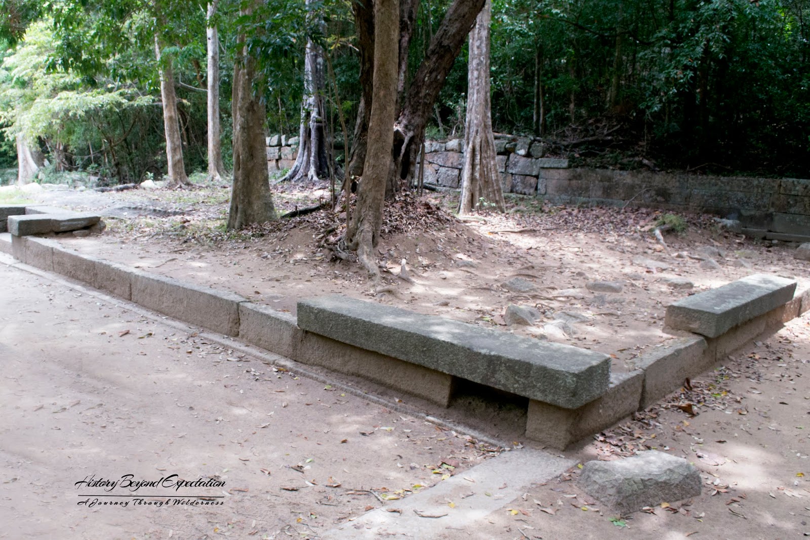
URINAL
(Still In Working Condition)

SCENERY FROM SO CALLED LIBRARY

VISITORS LOUNGE
VISITORS LOUNGE (1 & 2)


STONE DRAIN

The waterfall. It will be active during the North East monsoon period.


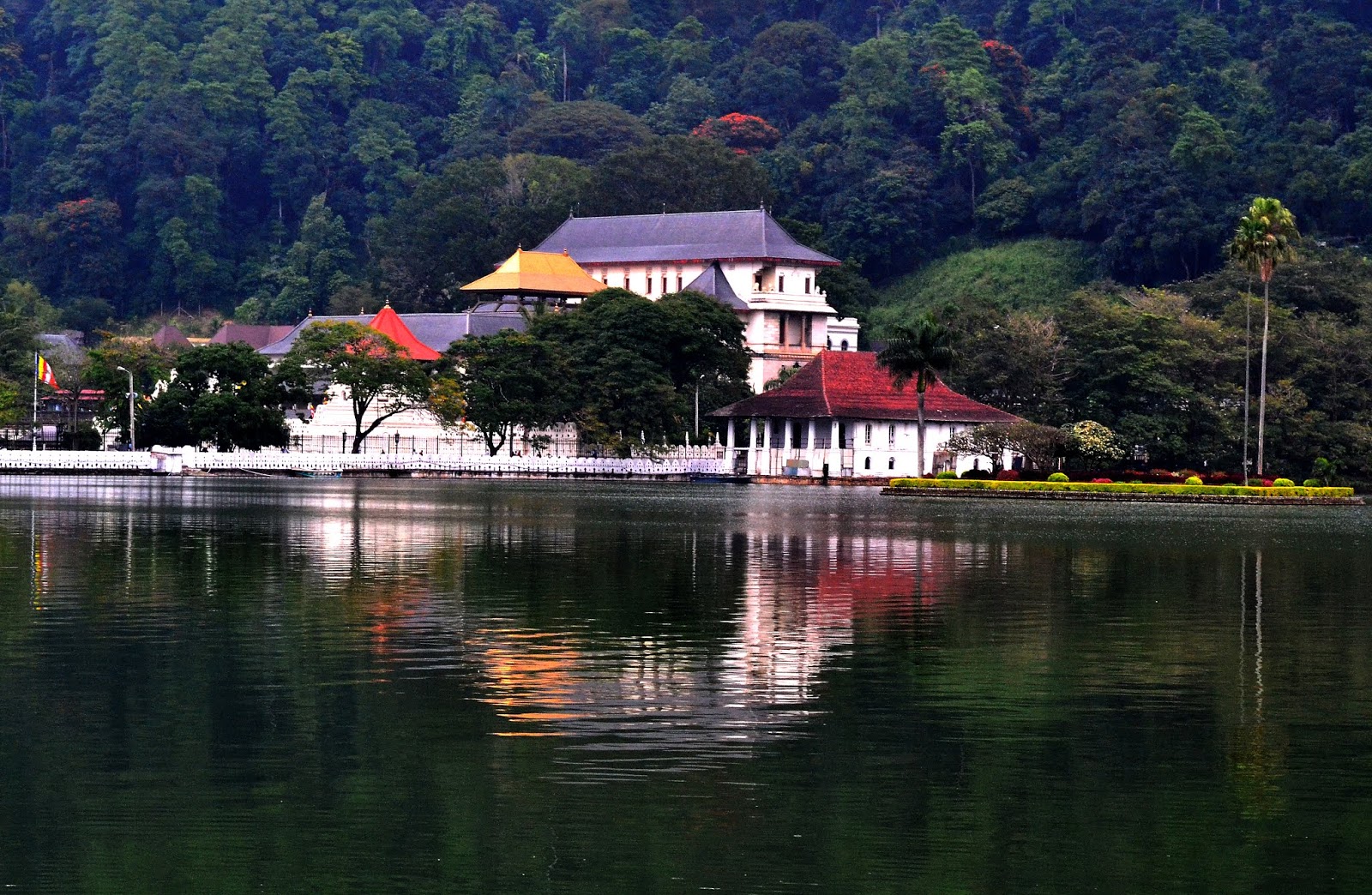
TEMPLE OF TOOTH RELIC IN KANDY
දළදා මාළිගාව මහ නුවර
ANGAMMEDILLA STONE WEIR
අංගම්මැඩිල්ල ගල් අමුන (රජ බැම්ම)


ANGAMMEDILLA STONE WEIR
අංගම්මැඩිල්ල ගල් අමුන (රජ බැම්ම)


ABAN GANGA (RIVER)
අබන් ගග


